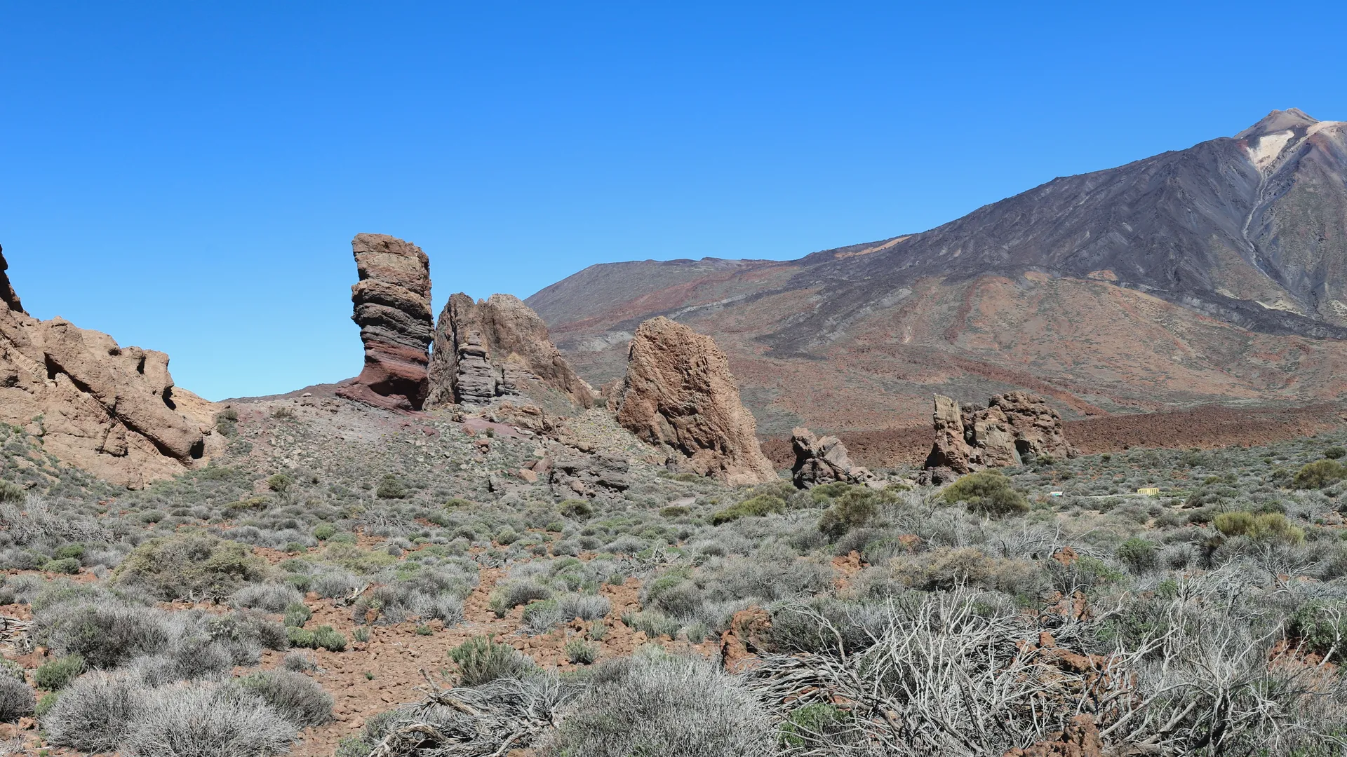
Teide: what the National Park is
The Teide National Park occupies the central caldera of Tenerife and is dominated by El Teide, a stratovolcano rising to 3,718 metres — the highest point in Spain and the third tallest volcanic structure in the world when measured from the ocean floor. The park was declared a UNESCO World Heritage Site in 2007 for its exceptional geological and landscape value.
The landscape is singular: lava flows of different ages, volcanic rock formations, endemic vegetation adapted to altitude and an expanse of sky that makes the horizon feel unusually far away. It is a place that bears little resemblance to anything else in the Canary Islands or, for that matter, to most places anywhere.
Visiting the park vs. ascending to the summit
These are two different things and it is worth being clear about the distinction before planning your visit. Visiting the National Park — driving up, walking around the Roques de García area, using the cable car as far as the upper station — is something that can be done on a day trip from Santa Cruz without advance booking for most of the experience.
Ascending to the actual summit crater (Pico del Teide, 3,718 m) is a different matter. It requires a permit from the National Park authorities, is subject to restrictions and closures, and involves a serious ascent at altitude. The cable car does not take you to the summit — it stops below it. The permit system and conditions are managed by the park authorities.
Key areas and viewpoints in the park
Roques de García
The most iconic formations in the park: a group of volcanic rock structures that emerge from the caldera floor. Walkable via a circular trail with exceptional views of Teide.
Parador Nacional del Teide
The historic hotel within the park serves as a reference point and rest area. The surrounding area offers excellent views of the volcanic landscape.
Cable car (Teleférico)
Takes visitors from around 2,356 m to the upper station at approximately 3,555 m. The views on a clear day are extraordinary. Book in advance at volcanoteide.com.
Mirador de Boca Tauce
A viewpoint on the western edge of the caldera with a very different perspective on the volcanic landscape and views towards La Gomera and El Hierro.
Montana Blanca
A light-coloured pumice peak on the south-east flank of Teide. One of the starting points for hiking routes within the park.
Llano de Ucanca
A broad flat area in the caldera, particularly photogenic at dawn and dusk. The colours of the volcanic rock change with the light throughout the day.
Getting to Teide from Santa Cruz
- Santa Cruz city centreStarting point · sea level
- La Laguna / Los RodeosFirst plateau, about 550 m
- La Esperanza forestPine forest on the ascent, around 1,000–1,500 m
- El PortilloPark entrance on the north side, about 2,030 m
- Caldera del TeideRoques de García, Parador, cable car · 2,000–3,555 m
The drive from Santa Cruz to the heart of the park takes approximately 60–75 minutes. The road ascends continuously and the landscape changes dramatically with each altitude band. There is no direct public transport connection from Santa Cruz. Car hire or organised excursions are the standard options.
Official sources
For all information on access, permits, trail conditions and current restrictions, always consult the official sources directly:
TENERIFE IN ONE DAY
From the Atlantic to 3,700 metres and back
The fact that you can wake up in Santa Cruz at sea level and stand in a volcanic landscape at more than 2,000 metres within an hour is one of Tenerife's most unusual qualities. Teide is one of the clearest expressions of what this island actually is: a young, living volcano in the middle of the Atlantic.
Continue exploring from Santa Cruz
YOUR STAY IN SANTA CRUZ
Discover Tenerife from DE VILLA SUITES
A complete apartment in Santa Cruz de Tenerife to enjoy the city at your own pace and use as a base for exploring the island.